- Your cart is empty Browse Shop
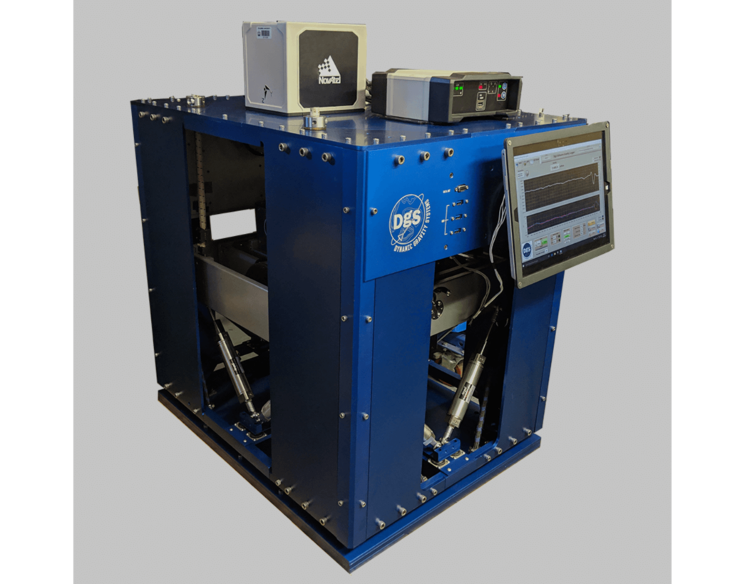
Airborne Gravimeter
The DGS Airborne Gravimeter is a premier, high-performance airborne gravity survey system built around a robust, full-force-feedback zero-length spring sensor with a worldwide measuring range of 20,000 mGal. The system completely replaces legacy mechanical moving parts like spring tension motors, gearboxes, and measuring screws with an advanced magnetic damping loop that locks the sensor beam instantly at the zero-reading line. This advanced feedback architecture dramatically stabilizes data quality under turbulent flight conditions, effectively reducing cross-coupling and non-linearity sensor errors to zero. It incorporates an integrated inertial platform control system driven by high-performance fiber optic gyros (FOG) and extended-range accelerometers to support demanding drape survey flights and sharp aircraft course corrections. Operating at a high-fidelity 10 Hz data and GPS recording frequency, it leverages microsecond-precise GPS timing synchronization to cleanly separate aircraft flight accelerations from underlying geological anomalies. Consuming an average of only 60 Watts and weighing roughly 80 kg, the weatherized, temperature-controlled field unit interfaces with a simplified, user-friendly data display configuration that requires zero operator manual control during active flight profiles. It represents an elite, highly reliable solution deployed internationally by world-renowned research institutes and exploration companies for continental shelf mapping, oil, gas, and mineral exploration, and deep geoid modeling.
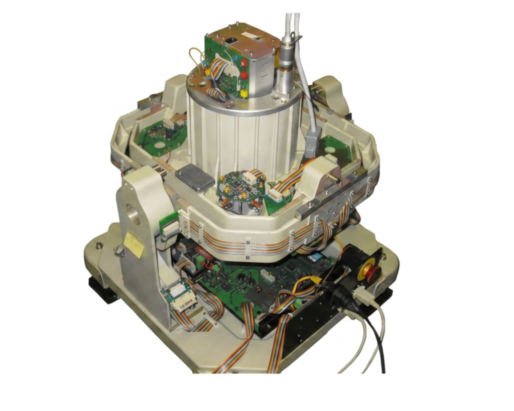
Marine Gravity Meter
The Marine Gravity Meter KSS32-M is a premier, high-performance instrument optimized for marine geophysical research, commercial oil prospecting, and foundational geodetic studies worldwide. By utilizing cutting-edge straight-line sensor technology paired with ultra-precise mechanics and advanced electronics, the system completely eliminates cross-coupling errors inherent in traditional spring designs. It delivers exceptional operational performance, achieving a measurement accuracy of better than 0.5 mGal alongside an incredibly low drift rate across a fully worldwide measuring range. The sensor remains highly linear even when subjected to intense vertical accelerations of up to 230,000 mGal (0.23 g), maintaining reliable data continuity. Thanks to its adaptive filtering algorithms, the KSS32-M ensures valuable readings and rapid recovery times during rough sea states, profile transitions, and turn-manoeuvre’s. Furthermore, the system includes robust safety features that automatically safeguard both the gravity sensor and the gyro-stabilized platform in the event of a sudden power failure.
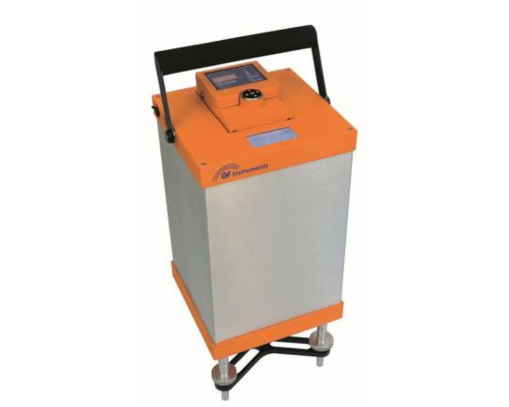
LG-1 Galileo – Land Gravity Meter
The LG-1 Galileo is a state-of-the-art land gravity meter engineered to meet the stringent demands of up-to-date high-precision gravimetric field surveys. It is equipped with a lightweight, temperature-balanced sensor built on a robust quartz core that delivers exceptional shock resistance in rugged environments. The system provides an extensive worldwide measuring range with an impressive repeatability of better than 5 µGal and a reading resolution of 0.1 µGal. It features a detachable control unit with a color graphic display and joystick operation, allowing users to closely monitor leveling and data quality. Complete with an 8 GB internal memory, built-in GPS, and hot-swappable Li-Ion batteries, it is ideal for oil, gas, and mineral exploration, cavity detection, and structural civil engineering tasks.
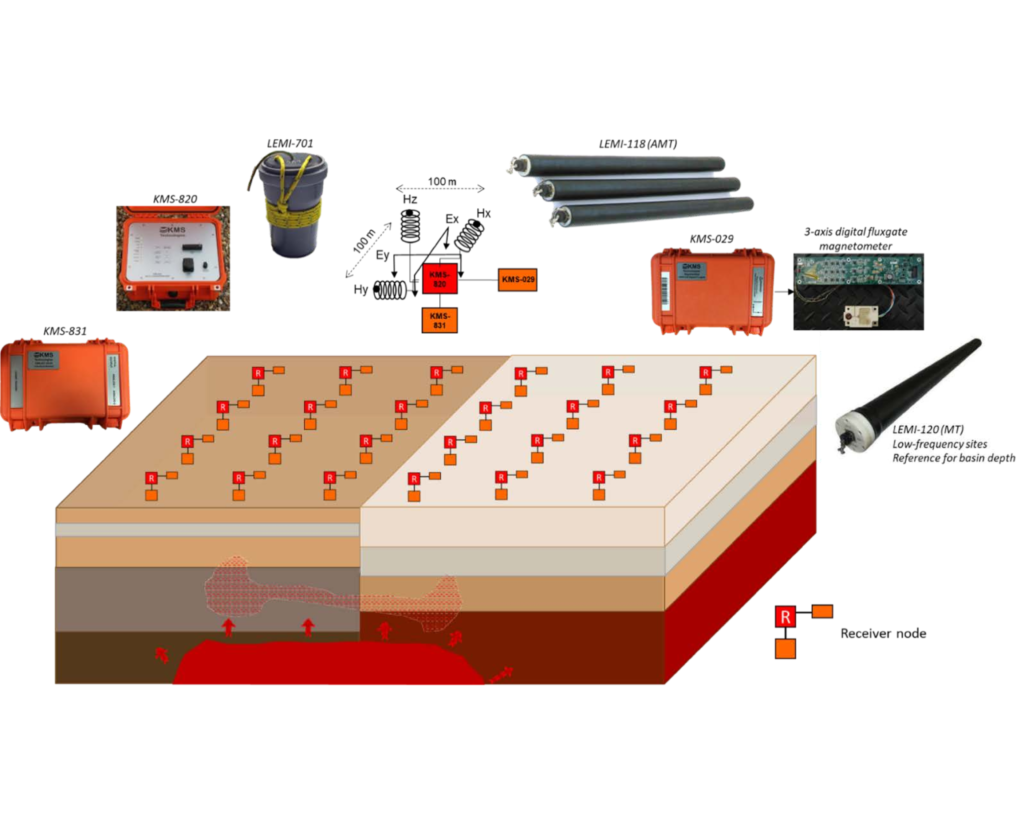
Magneto Telluric (MT) Survey System
Magnetotellurics (MT) and Audio MT (AMT) target different depths of investigation, natural MT signals come from a variety of induced currents caused by thunderstorms and the ionosphere. The frequency ranges of MT data spans from 0.0001 Hz to 1,000 Hz and for AMT from 10 Hz to 20 kHz.
MT is usually used to map conductive zones such as geothermal zones or sediment packages. For geothermal application, one often requires the high frequencies and only limited low frequencies. For this we developed a combination between an array with sub-acquisition nodes and low frequency fluxgate receivers (KMS-820 MT Mini package).
We are adopting the concept of 3D bin-based MT acquisition which uses limited magnetic field but denser electric field data.
Controlled-Source Electromagnetics (CSEM) complements MT/AMT by actively injecting low-frequency current (e.g., a grounded dipole) and measuring the induced responses. It is especially sensitive to resistive targets, helps reduce MT ambiguity, and can reuse the same electrode layouts with compatible magnetometers. Frequencies and waveforms are selected to match target depth and site conditions.
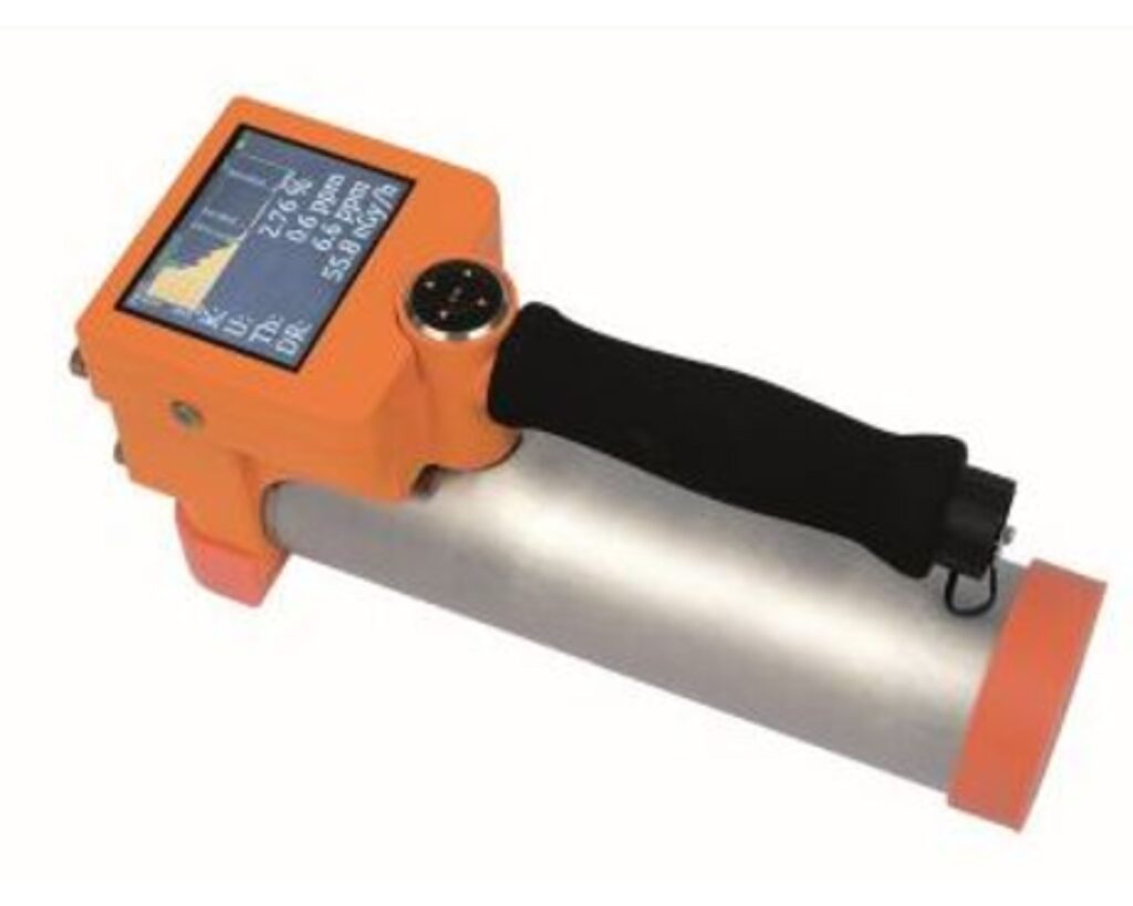
Gamma-Ray Spectrometers
The Gamma Surveyor Vario is a highly versatile 2048-channel geophysical gamma-ray spectrometer built for field exploration, borehole logging down to 100 meters, and carborne surveys. It features specialized measurement modes for potassium, uranium, and thorium (K, U, Th) assays alongside natural gamma dose rate mapping and selective radioactive source searching. The system utilizes exchangeable compact probes featuring high-sensitivity BGO or NaI(Tl) scintillation detectors that can be mounted horizontally or vertically. Precise real-time spectrum stabilization is achieved using either natural ambient isotopes or an artificial stabilization source, ensuring reliable data collection even at low activity levels. Its control software supports full spectrum visualizations, a comprehensive isotope library, and convenient data exports via USB
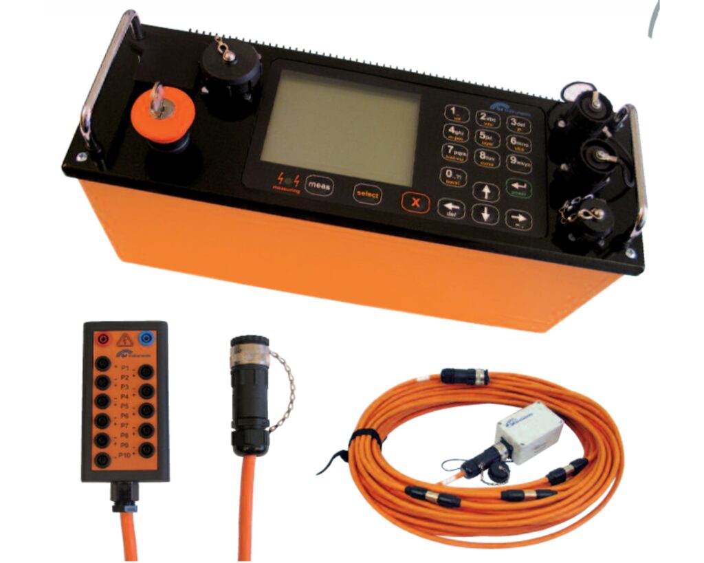
Resistivity & Induced Polarization Systems (ARES II)
The ARES II represents an advanced, automatic multi-channel resistivity and induced polarization (IP) imaging system optimized for 2D, 3D, and 4D tomography. It integrates a powerful transmitter (up to 850 W, 2000 Vp-p) and a highly sensitive 24-bit receiver into a single ruggedized, weatherproof field unit. The system operates effortlessly using either passive cables with a switch box or active multi-electrode cables supporting up to 65,000 electrodes in one array. It features automatic pulse cycling, built-in grounding checks, and real-time decay curve visualizations directly on its graphical LCD screen. This equipment is widely deployed worldwide for groundwater exploration, civil engineering investigations, dam monitoring, and mineral prospecting.
Absolute Quantum Gravimeter
Exail’s Absolute Quantum Gravimeters (AQG) provide a revolutionary leap forward by unlocking precise, drift-free tracking of subsurface mass movements. By measuring micro-Gal level variations in absolute gravity, these quantum sensors allow scientists to detect the localized crustal density fluctuations and deep-seated fluid migrations that frequently precede seismic ruptures. Because the technology relies on dropping clouds of laser-cooled rubidium atoms rather than mechanical components, it completely eliminates instrumental drift, ensuring the highly stable, multi-year time-series data necessary for long-term tectonic monitoring. This high-precision tracking allows geophysicists to map stress accumulation along active fault lines and, when integrated into advanced early-warning frameworks, aids the study of prompt gravity perturbations that travel at the speed of light ahead of slower seismic waves. Furthermore, Exail’s active vibration compensation gives the AQG excellent immunity to continuous ambient ground noise, allowing it to remain highly accurate in volatile seismic or volcanic zones. Finally, the field-ready portability of the AQG-B version enables rapid deployment following a major earthquake, allowing researchers to track critical post-seismic slip, land subsidence, and the long-term relaxation phases of the fault zone.
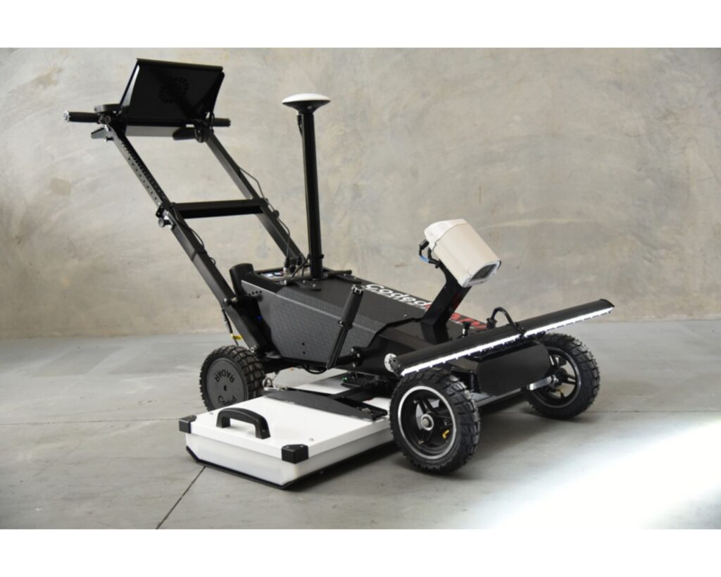
Push-Cart 3D Noise Modulated-GPR
The Lynx is a compact, high-performance push-cart platform designed for high-resolution 3D subsurface and surface imaging in a single walk-behind pass. It utilizes proprietary Noise-Modulated Ground Penetrating Radar (NM-GPR) technology to capture data thousands of times faster than traditional GPR, entirely bypassing the depth and speed compromises of conventional systems. The platform comes equipped with a built-in PC, flexible data positioning options (including RTK-GNSS, robotic total stations, or grid-based scanning), and an optional storable line-scan surface imaging camera with an integrated lighting array. Designed for total field mobility, the system features a fold-away or removable light array to allow for effortless transport across rugged job sites. It functions as a powerful, ultra-precise tool for geotechnical investigations, utility mapping, concrete deck inspections, and localized urban site context surveys where GPS signals may be unreliable.
Electromagnetic (EM) and Resistivity/Induced Polarization
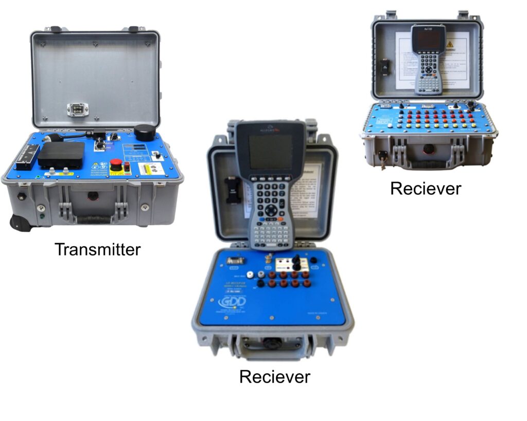
Resistivity / Induced Polarization (IP) Transmitter, model Tx4
Resistivity/Induced Polarization(IP) Transmiter of 5000W-2400V-20A was developed using the latest technology. The digital Tx4 can now reach 20A, is more ergonomic and will allow you to save time and money. Reliable and robust, the GDD IP Transmitters are used over the world for Resistivity and Time-Domain Induced Polarization (IP) surveys for a wide range of applications. 10,000W-4800V Master/Slave option allows faster readings and increases productivity.
Resistivity/Induced Polarization (IP) GDD Receivers
hese Receivers are compact and low power consumption designed for Resistivity and Induced Polarization (IP) surveys. They are rugged and can be used under any field conditions. Our receivers include an optimized noise reduction algorithm. You can also visualize your pseudo section in real time!
Magnetic Susceptibility Meter
It is designed for fast field mapping and in-situ assessment of paramagnetic, diamagnetic, and ferromagnetic materials across domains like geological surveys, archaeology, and raw material prospecting. The lightweight, rugged system supports both manual spot measurements and continuous mapping modes. It features built-in GPS positioning with a real-time map preview. For varied investigation depths, the system utilizes exchangeable single-depth or multi-depth probes (ranging from 12 cm to 50 cm axial depth ranges).
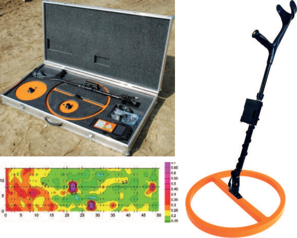
Electromagnetic Conductivity Meter
Large family of electromagnetic conductivity meters is designed for survey depth ranges from 0.15 to 60 m. Used contactless method allows fast measurement of conductivity and inphase under all field conditions (including very dry and icy ground). Probes are equipped with 1, 3 or 6 receivers with excellent temperature stability. This way makes high resolution depth graded mapping as well as imaging of sections possible and useful for wide range of walking and moving applications.
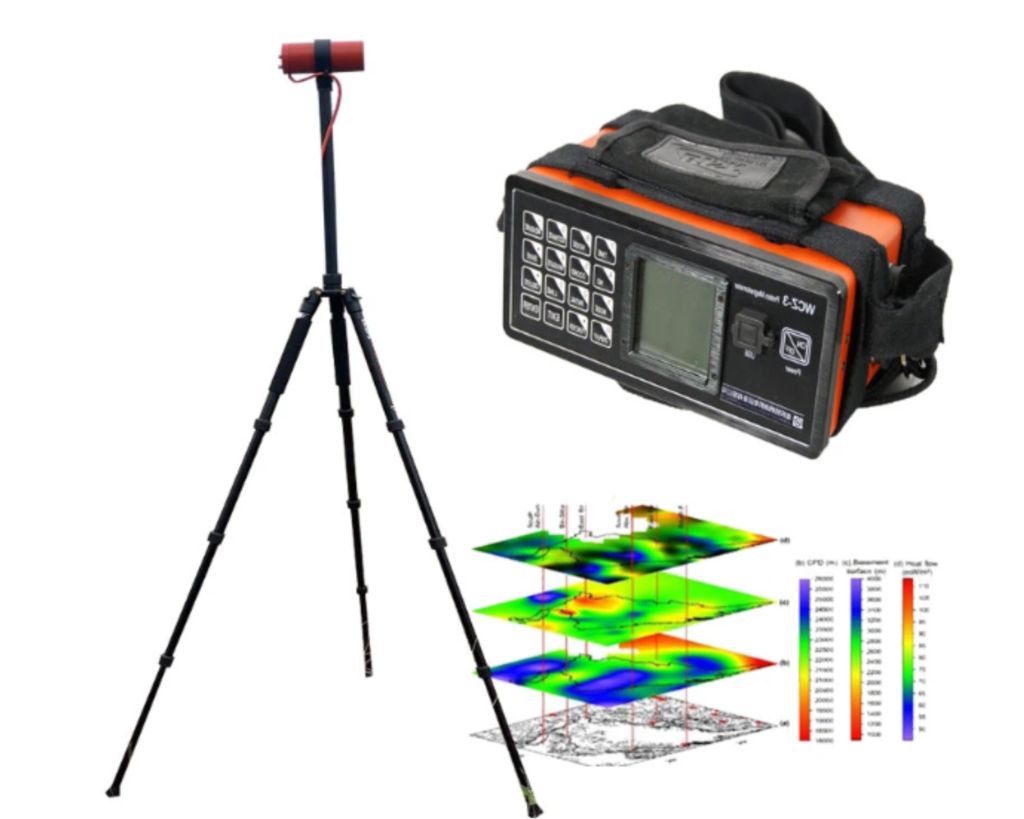
Proton Magnetometer
It is a new generation, light weight and portable proton magnetometer. It uses a thermostatic crystal oscillator with high accuracy and stability to make it more stable. It supports Standard GPS, GNSS, Beidou and GLONASS systems, which provides location and accurate time synchronization. The time synchronization accuracy reaches 30 ms, which is more convenient to use. It supports mobile, walk or base station mode. It is mainly applied in minerals exploration (such as iron ore, lead-zinc ore, copper ore, etc.), geophysical exploration in geological structures, archaeology, earthquake, volcanic activity research and long-term geomagnetic measurement stations.
Borehole Loggers
Geophysical logs provide petrophysical property information important to exploration geophysicists, geologists, mine managers, and multi-disciplinary professionals involved in exploration, mine-site production and development, mine de-watering, and many other mining industry demands. Mount Sopris geophysical logging tools have been demonstrated in a wide variety of geologic environments often found in an exploration setting and have proven useful in geologic interpretations and in-situ mineral evaluation.
Our slimline probes and easy-to-use portable geophysical logging systems are ideally suited for shallow, near surface environmental applications.
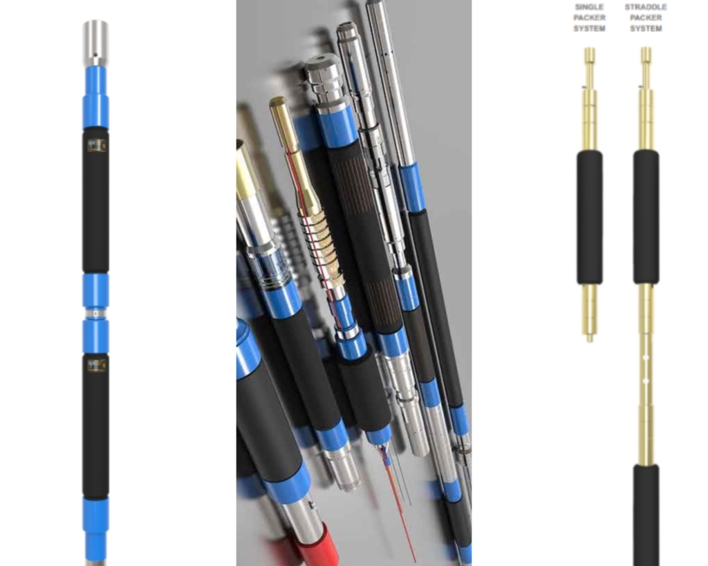
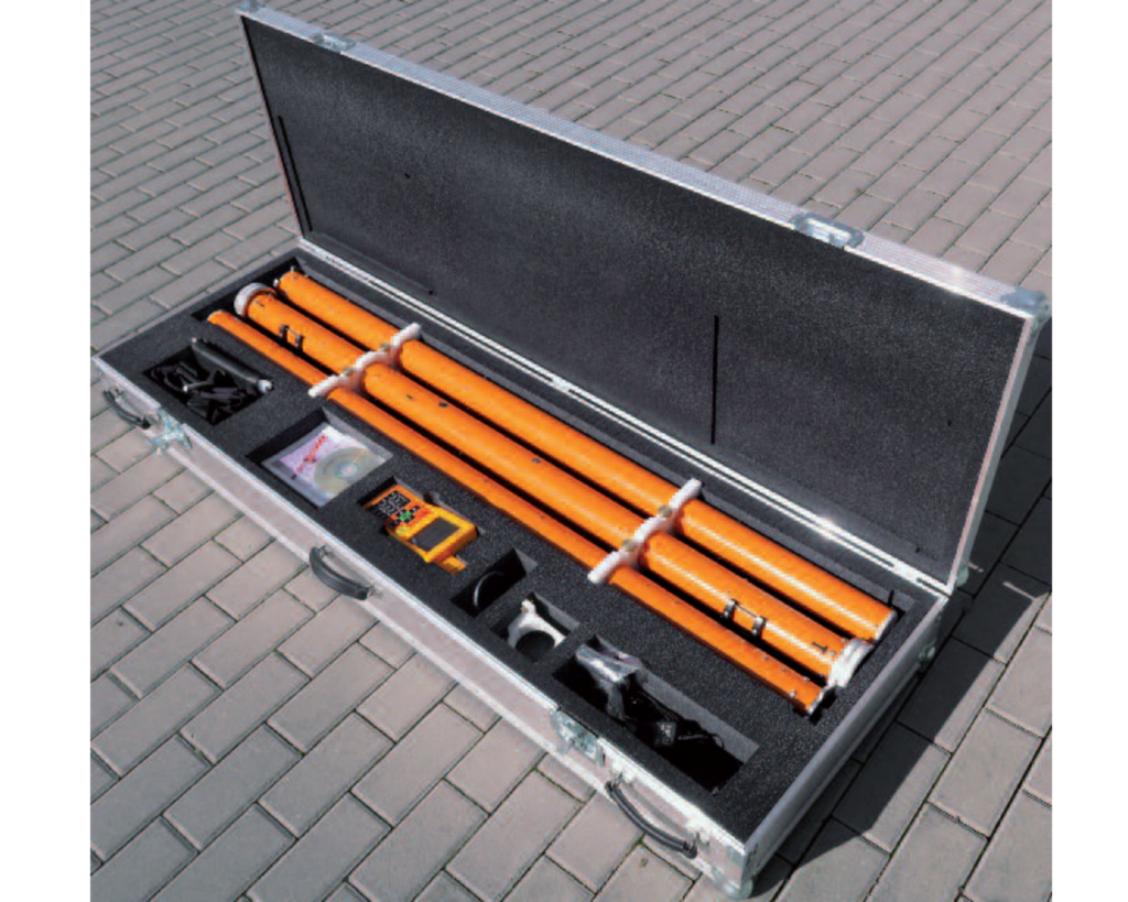
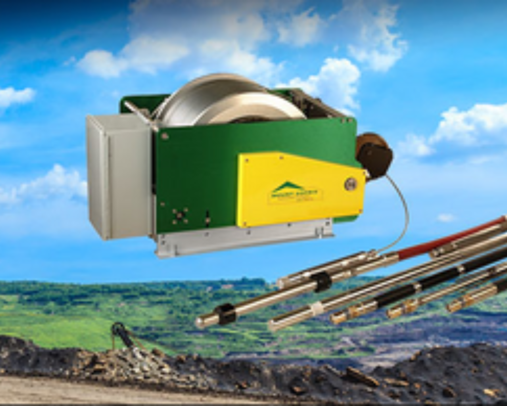
Borehole Packers
IPI is the global market leader in the provision of inflatable packers for rock burst mitigation, block caving, hydro fracturing, remote or deep permeability testing, rock-stress testing, pressure grouting, well construction and repair, ISR mining, ASR injection, solution mining, and custom-made solutions.
Designed specifically to suit preconditioning for rock burst mitigation and for block caving via very high-pressure hydraulic fracturing. IPI packers deflate faster and recover to their original diameter better than any packers on the market, enabling them to be run with lower annular clearances.