- Your cart is empty Browse Shop
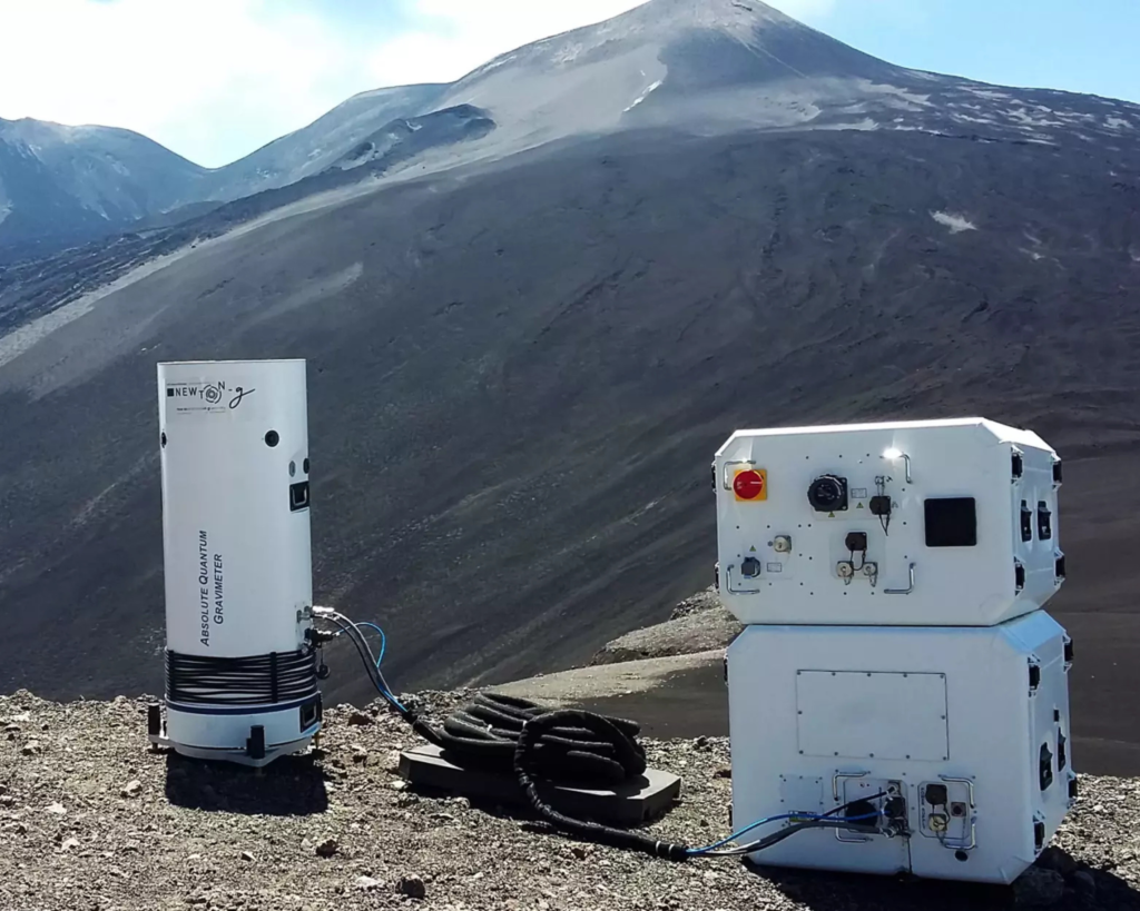
Absolute Quantum Gravimeter
Exail’s Absolute Quantum Gravimeters (AQG) provide a revolutionary leap forward by unlocking precise, drift-free tracking of subsurface mass movements. By measuring micro-Gal level variations in absolute gravity, these quantum sensors allow scientists to detect the localized crustal density fluctuations and deep-seated fluid migrations that frequently precede seismic ruptures. Because the technology relies on dropping clouds of laser-cooled rubidium atoms rather than mechanical components, it completely eliminates instrumental drift, ensuring the highly stable, multi-year time-series data necessary for long-term tectonic monitoring. This high-precision tracking allows geophysicists to map stress accumulation along active fault lines and, when integrated into advanced early-warning frameworks, aids the study of prompt gravity perturbations that travel at the speed of light ahead of slower seismic waves. Furthermore, Exail’s active vibration compensation gives the AQG excellent immunity to continuous ambient ground noise, allowing it to remain highly accurate in volatile seismic or volcanic zones. Finally, the field-ready portability of the AQG-B version enables rapid deployment following a major earthquake, allowing researchers to track critical post-seismic slip, land subsidence, and the long-term relaxation phases of the fault zone.
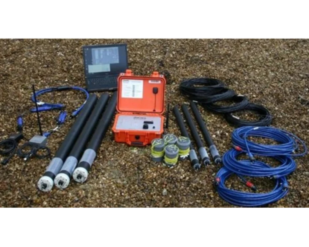
Magneto Telluric (MT) Survey System
provides vital subsurface data by integrating deep-penetrating electromagnetic (EM) systems with seismic monitoring techniques. The company specializes in advanced technologies like Magnetotellurics (MT) and Long Offset Transient Electromagnetics (LOTEM) to image deeply buried active fault zones and trace fluid migrations that frequently act as triggers for regional seismic activity. By integrating these high-power EM instrumentation packages with microseismic monitoring networks, researchers are able to couple changes in crustal electrical resistivity with real-time micro-fracturing and tectonic stress accumulation. This joint interpretation workflow drastically improves the depth and structural resolution of 3D geological models, particularly in complex basins where seismic imaging alone is obstructed by over-thrusting salt or basalt layers. Furthermore, KMS Technologies’ robust 3D forward modeling and anisotropic inversion software allows geophysicists to accurately predict and evaluate time-series variations in subsurface conductivity. Ultimately, these integrated, permanent array setups provide the foundational geophysical datasets necessary to characterize active seismogenic zones and enhance regional earthquake hazard assessments.
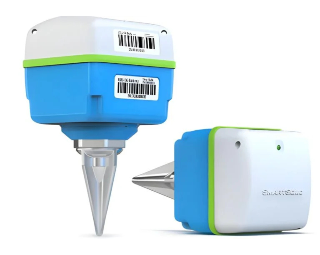
Smart Solo Seismic Sensor
In earthquake and seismological research, SmartSolo significantly advances hazard assessment by pioneering the use of highly portable, short-period nodal seismometers for “Large-N” ultra-dense array studies. Their compact, cable-free 3-component smart seismic sensors allow researchers to rapidly deploy thousands of nodes across complex or active fault zones, capturing high-resolution subsurface imaging that traditional sparse networks cannot resolve. These rugged, IP68 waterproof units are engineered with high-precision internal GPS time-disciplined clocks and 32-bit ADCs to ensure perfect synchronization and low-noise data continuity across vast areas. Geophysicists leverage this dense data to map fine-scale crustal structures, construct precise 3D S-wave velocity models, and accurately locate micro-earthquakes or subtle tectonic tremors that act as precursors to major ruptures. Additionally, technologies like their broadband integrated seismographs feature optimized low-frequency detection specifically suited for tracking long-term tectonic plate movements and slow earthquakes. Ultimately, by integrating these vast nodal datasets with modern AI processing for noise reduction and feature extraction, SmartSolo enables precise modeling of tectonic asperities—such as those driving major events like the 2024 Noto earthquake—drastically improving regional seismic risk mitigation.